Switzerland · France · The Jura Plateau
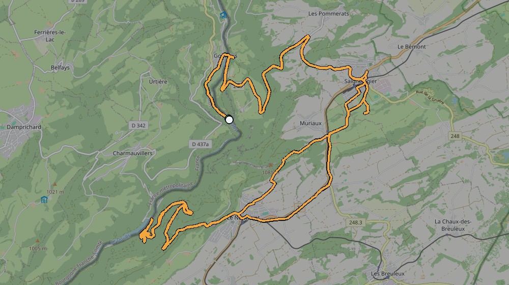
The double climb that defines Goumois riding — up to Saignelégier, across to Le Noirmont, down to La Goule, and back.
Ridden 23 June 2019, and described in Kevin’s own ride log in full: "This is a great double climb from the base of the french/swiss border in Goumois by the river up the climb to Seignelegier then across the Noirmont and then down the mountain to LaGoule. There is a restaurant there for a coffee. Then straight back up the climb and then back down the first climb to the beginning."
And the extension, for anyone wanting more: "In LaGoule you can go into France and climb up the other side and back across to Goumois through France. However that climb is short at 3 kms, but it is really steep at around 20% plus for the whole of the 3 kms." That extension isn’t included in this ride’s own distance/climbing figures below — see the La Goule page for that climb on its own.
The route, from Kevin's own GPS track
📝 Kevin — needs your input
- Confirm the restaurant at La Goule — is it still there, worth naming?
- Is this the route you'd point a first-time visitor to as "the" Goumois ride?